
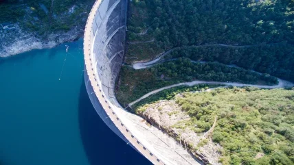
As the number and severity of extreme weather events continue to increase worldwide, Upstream Tech believes that hybrid modelling can improve forecasts and lead to improved safety and increased revenue for hydropower operators and water management teams.
Our changing climate is witnessing an increase of hydrological events such as flooding, and storms that cause flooding. This, along with climatological events such as extreme temperature and drought, is creating a requirement for more risk management geared towards the development of better strategies and technology to manage water resources.
As historical weather conditions become increasingly less applicable to current and future conditions, there’s an expanding gap between long-term averages of inflow versus what we’re seeing today and what we’ll see going forward. This is further complicated as weather forecasts often disagree and historical relationships for runoff generation no longer hold true.
This can be illustrated by the Colorado Basin in California which during 2021 had an average snowpack of 84% but only received about 58% of expected flows from the runoffs. Such volatility is making the prediction of accurate forecasts increasingly difficult.
To address a hybrid approach to modelling is considered to be the best way forward. Although physical models use known equations and each part is explicitly represented, they use single basin data to calibrate and constrain. However, the challenge here is that changing conditions are reducing accuracy over time and it can take physical models a while to calibrate and incorporate new data, meaning they can be slow to adapt.
Whilst statistical models are empirical and data-driven, can learn over time and be highly flexible and adaptive, they are prone to false correlations and unrealistic outcomes as they’re not constrained by hydrological rules. They were unable to apply data input in a real-world setting.
So the theory behind a hybrid modelling approach is to take the best parts of both physical and statistical modelling and minimise their downsides.
Upstream Tech’s HydroForecast modelling is described as being like a hydrologist. It is trained across more than 500 basins and is able to apply this knowledge anywhere. As it has an enormous amount of information to reference and build upon, when it sees anomalies such as a 1-in-1000-year flood event, it understands as it has seen so many different types of hydrological conditions. This creates a universally applicable forecasting approach.
What data goes into the model?
Global forecasts begin with global inputs and a flexible model. They require the best water, weather and climate data available which includes meteorological, satellite observations, geospatial datasets and in situ measurements.
Although historical and in situ data is still very important to finetune and train a model to a specific basin, as historical data becomes less reliable, other inputs are able to account for this or if flow data is missing, are able to assimilate and overcome the missing values.
Satellite imagery also has a role to play in providing accurate information. For example, vegetation imagery tracks landscape changes, such as those caused by forest or bushfires. HydroForecast sees this change daily and learns how streamflow is impacted. While in colder climates snow imagery is very important as it aids understanding of snow water and other critical factors that affect runoff. This helps to interpret the potential for hydropower generation and water planning purposes and is particularly useful during the freshet or after a large storm.
Abnormal is the new normal but this is making it increasingly difficult to accurately predict hourly peak flow timing and magnitude in big basins when basin responses, weather patterns and storms are changing in ways unseen before. This is where the use of a distributed model is valuable to predict routing, flow and gains and losses. Splitting basins into sub-units instead of a single lumped unit enables a more accurate prediction to be made.
Hydropower and water utilities need to look decades ahead to plan for water shortages and meeting energy/supply targets plans. However, a normal year now feels like a rarity, there’s a quick and striking variability from dry to wet years, weather forecasts beyond two weeks have low skill, while the long-term average is no longer a suitable predictor.
To address this Upstream Tech has developed a probabilistic forecast that combines historic and future weather forecasts. HydroForecast Seasonal predicts 90-day flow using a combined analogue model from the past 40 years of weather data with a synthetic weather trace forward-looking model to capture upcoming events.
In recent years HydroForecast has been able to predict the impacts of severe weather events. Hurricane Ida was a powerful Atlantic Hurricane which moved through the southern parts of the US at the end of August 2021. The region is heavily rain driven and flashy storms occur quickly in the summer months, but HydroForecast was able to predict the impacts in the Emory River at Oakdale in Tennessee from 31 August to 3 September. While during the spring of 2022 it was also able to accurately predict a rain-on-snow event, a tricky event which can be difficult to forecast, at North Fork Dam on the North Fork American river in California.
This article first appeared in International Water Power magazine.


